Explore Cherokee Marsh Public Lands. Area map with major trailheads and boat landings.
Cherokee Marsh Conservation Park (City of Madison), three units:
North Unit
Hiking, snowshoeing, skiing (ungroomed).
6098 N. Sherman Ave.Follow N. Sherman Ave. north to the parking lot at the end of the gravel road. Get directions.
South Unit and School Road Boat Landing
Hiking when trails not snow-covered, skiing (groomed).
5002 School RdHeading north on Northport Drive/HWY 113, turn right on School Rd. Where the road curves right onto Wheeler Rd. take an immediate left into Cherokee Marsh Conservation Park. Park in the small lot along the street or follow the gravel road to the boat landing and additional parking.Get directions.
Mendota Unit
Hiking, snowshoeing, skiing (ungroomed).
Access the trails from Westport Meadows Park on Beilfuss Dr. or from Sauthoff Rd. Get directions.
Meadow Ridge Conservation Park
Hiking, snowshoeing, skiing (ungroomed).
4002 Meadow Valley Drive, Get directions.
Cherokee Marsh Fishery Area (WDNR).
Cherokee Marsh Public Access site (WDNR). This property is adjacent to the northwest boundary of Cherokee Marsh Conservation Park – South Unit. map
Yahara Heights County Park and Cherokee Marsh Natural Resource Area (Dane County)
Hiking, skiing (ungroomed), snowshoeing. Dog exercise area.
The west end of the Cherokee Marsh Natural Resource Area is Yahara Heights County Park, which includes a dog exercise area and expanses of restored prairie and woods. The Natural Resource Area continues to the north and east between the Yahara River and River Rd.
West entrance (Catfish Ct): heading north from Madison on HWY 113/Northport Dr., 1/3 mile past HWY M, turn right on River Rd., then immediate right onto Catfish Ct. There is a small parking area for the trail system just before the fenced dog exercise area. The address for navigating is Catfish Ct, Waunakee, WI 53597.
East entrance (River Rd): heading north from Madison on HWY 113/Northport Dr., 1/3 mile past HWY M, turn right on River Rd on continue for 1.5 miles. A small parking area is on the right (south) side of the road.
The Yahara Heights Park brochure shows trails, points of interest, and more. Designed by Erika Zar. If printing double-sided, select “flip on short edge.”
State Natural Areas
A portion of Cherokee Marsh is the Cherokee Marsh State Natural Area.
Also in the Cherokee Marsh watershed is the Westport Drumlin Prairie Unit of the Empire Prairies State Natural Area.
Cherokee Park is a Madison city park adjacent to the marsh.
For Paddlers
Cherokee Marsh is included in the Yahara Waterways Water Trail Guide.
The Yahara Headwaters water trail travels through the marsh. From Capitol Water Trails.
Kayak rentals are available from Skipper Bud’s of Madison.
Watershed Maps
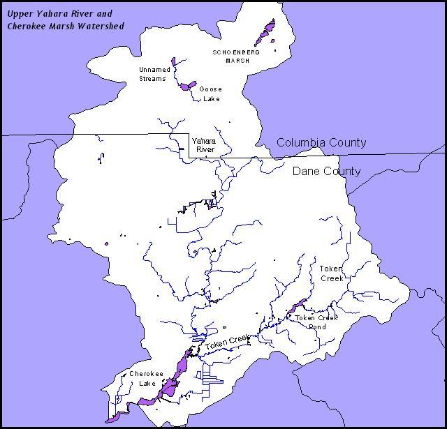
The upper Yahara River watershed
The Yahara River and Lake Mendota watershed boundary and planned growth areas. From Dane County Planning and Development.
Hands-on environmental education
The Cherokee Marsh Naturalist Program provides skilled naturalists to lead hands-on environmental education for students of all ages. More information.
Regulations
Slow, No-wake Zone
The Yahara River is slow, no-wake from Hwy 113 upstream to the mouth of Token Creek. Red-and-white, striped buoys mark the river boundary with Cherokee Lake adjacent to the Cherokee Park neighborhood. The slow, no-wake restriction was enacted by local ordinances and approved by the Department of Natural Resources in 1995. During times of high water, Dane County also declares Cherokee Lake as no wake to protect the shoreline from erosion. Informational signs are at the School Rd. boat landing and the Hwy 113 bridge.
Slow, no-wake means the speed at which a boat moves as slowly as possible while still maintaining steerage control.
Dane County’s slow, no-wake page includes any current emergency slow, no-wake orders.
Dogs
Dogs are allowed in these areas:
Yahara Heights Park has a dog exercise area and allows leashed dogs in the rest of the park.
Cherokee Marsh Natural Resource Area allows dogs on leash.
Cherokee Marsh Fishery Area allows dogs but may require leashing during nesting season. (Check the signs where you enter.)
Dogs are not allowed:
in Cherokee Marsh Conservation Park or other City of Madison conservation parks.
Bikes
Bicycling is not allowed in Cherokee Marsh Conservation Park or Yahara Heights County Park.
Hunting
Deer, waterfowl, and other game hunting are allowed in the Cherokee Marsh Fishery Area. Waterfowl hunting is allowed in the upper Yahara River including the DNR Cherokee Marsh Public Access site. A portion of Yahara Heights County Park and the Cherokee Marsh Resource Area are open by permit to archery hunting for deer and turkey.